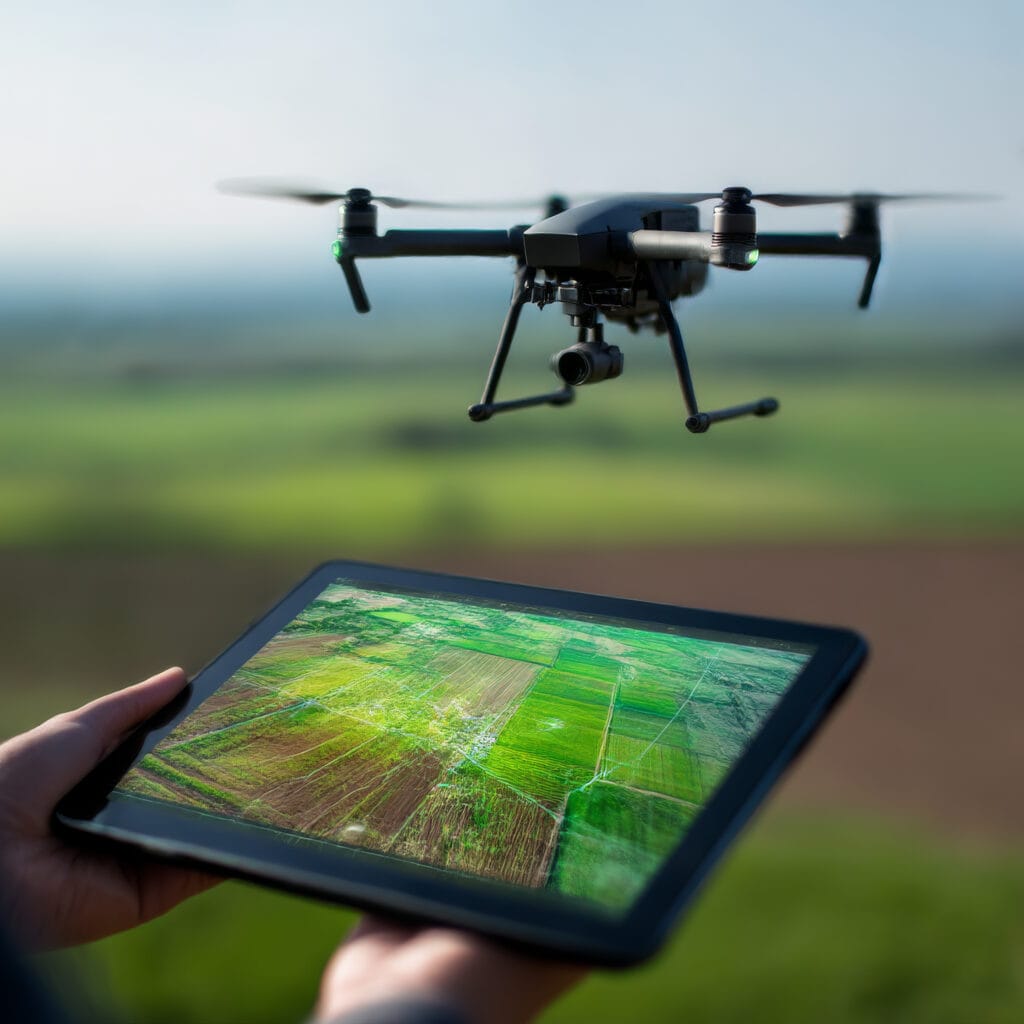
Drone mapping services have revolutionized conventional agriculture by providing precise and efficient data collection methods that significantly enhance farm management practices. These services use advanced aerial imaging to capture high-resolution images of crops, allowing farmers to monitor plant health, identify pest infestations, and assess soil conditions with greater accuracy than traditional methods.
By creating detailed maps of their fields, farmers can implement precision agriculture techniques, optimizing the use of resources such as water, fertilizers, and pesticides.
Harnessing the power of advanced laser technology, we specialize in providing comprehensive 3D terrain and structure data for various industries. Our LiDAR services enable us to capture elevation models, topographic maps, and volumetric analyses with exceptional detail and accuracy.
By leveraging our expertise and cutting-edge equipment, we deliver actionable insights and reliable data for informed decision-making. Let us elevate your projects with our exceptional LiDAR mapping capabilities. Contact us today to explore the possibilities and unlock the full potential of LiDAR technology.
Our photogrammetry capabilities redefine efficiency and affordability. With our advanced aerial imagery techniques, we offer a cost-effective solution for clients who prioritize high-quality mapping with a lower requirement for absolute accuracy. Our photogrammetry services utilize high-resolution aerial imagery to create detailed 3D models and orthomosaic maps, providing a comprehensive visual representation of your project area.
Contact us today to explore the advantages of our cost-effective and visually impressive photogrammetry solutions.
Note: Southwest Drone Service is not a licensed survey company. Southwest Drone Service only provides data collection and processing services for the purpose of interpretation by a Licensed Florida Surveyor only. Nor do we make any claims to accuracy of collected data.
In a world of constant improvement, drone surveys take property mapping to the next level. Our drones can capture detailed aerial images, creating high-resolution maps of the area. These maps provide valuable information for various industries like agriculture, construction, real estate and land surveying.
With drone surveys, you can generate 3D models, orthomosaic maps, and even conduct volumetric measurements accurately. The data collected through drone surveys is precise, cost-effective, and can be used for planning, monitoring, and decision-making processes all of which are immensely beneficial to business.When it comes to mapping the only solution is drones.
The frequency of drone mapping may vary depending on the specific needs and goals of the farm. Some farmers may prefer weekly or bi-weekly surveys for continuous monitoring, while others may opt for seasonal mapping aligned with critical growth stages to make informed decisions.
Drone mapping provides several benefits to South Florida’s agriculture sector:
Enhanced Crop Monitoring: Drones offer a comprehensive view of crop health and growth patterns, allowing farmers to detect issues such as pest infestations or nutrient deficiencies early.
Improved Resource Management: By analyzing data from drone maps, farmers can make informed decisions about irrigation, fertilization, and pest control to optimize resource use.
Increased Efficiency: Drones can cover large areas quickly, reducing the time and labor required for various tasks compared to traditional methods.
Precision Agriculture: Data collected aids in implementing precision agriculture practices, ensuring that inputs like water and fertilizer are used efficiently and only where needed.
Drones can collect various types of data useful for agricultural purposes, including:
Aerial Imagery: High-resolution images for mapping and analysis.
Multispectral and Thermal Imagery: Helps assess plant health, water stress, and soil conditions.
3D Models and Topographical Maps: Useful for understanding field elevations and drainage patterns.
While drones can be beneficial in various agricultural settings, factors like field size, location, and crop type can influence their effectiveness. It is essential to assess whether drone mapping aligns with your specific farming operations and goals to maximize its potential benefits.
Yes, using drones for agricultural mapping is subject to federal and state regulations. Operators must comply with the Federal Aviation Administration (FAA) guidelines, including having a Part 107 certification for commercial drone use. Additionally, local regulations may dictate the permissible altitude and privacy considerations.
Whether you have questions about our services, want to discuss a potential project, or simply need more information, our dedicated team is here to help. Get in touch with us using the contact details below:
6755 State Rd 80. LaBelle, FL 33935
South Florida
Monday-Friday, 9 a.m.-5 p.m. Closed on Federal Holidays.